yahoo Press
Nor’easter, 'blockbuster snowfall' could be brewing for weekend
Images
1 / 18
2 / 18

3 / 18

4 / 18

5 / 18
6 / 18

7 / 18
8 / 18

9 / 18

10 / 18

11 / 18

12 / 18

13 / 18

14 / 18

15 / 18

16 / 18

17 / 18

18 / 18
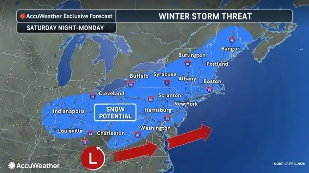
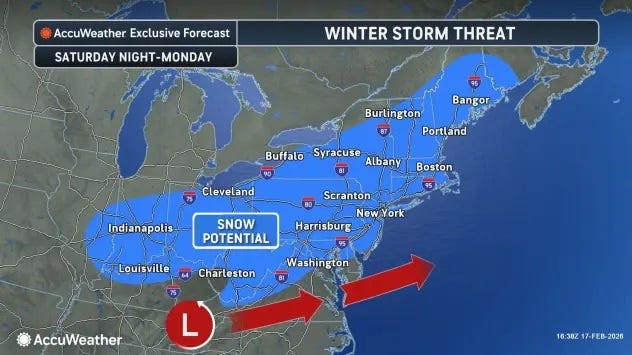
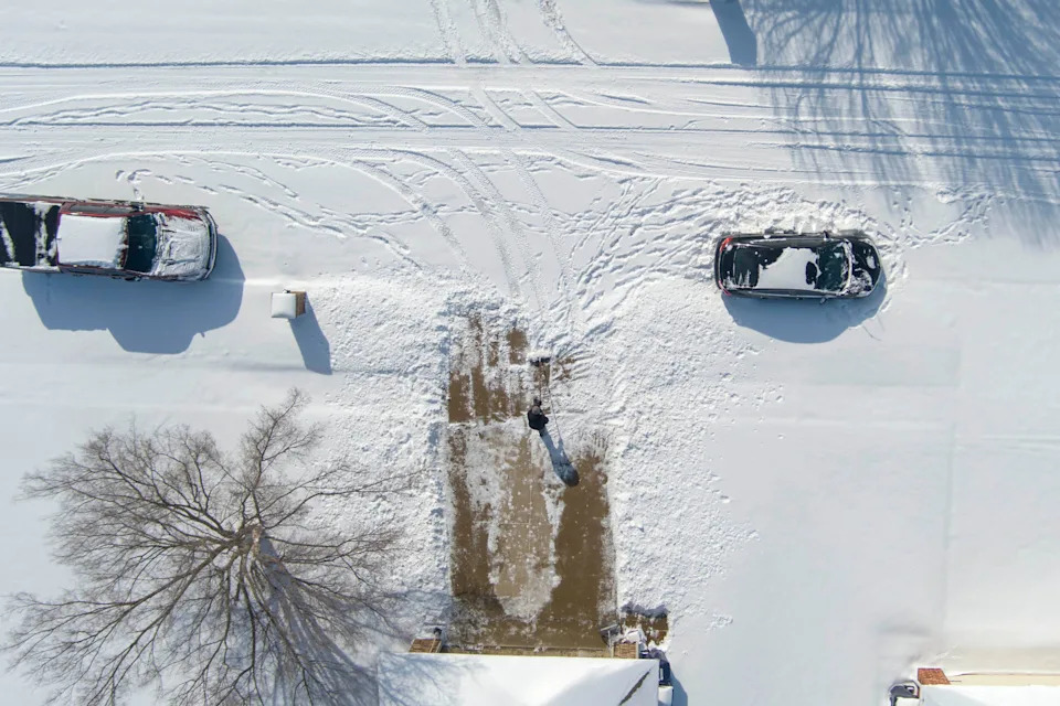
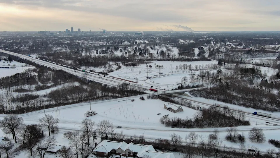
Editor's note: Follow the latest forecast developments in USA TODAY's coverage for Wednesday, February 18.

It might head out to sea, or it might be a 'blockbuster" late-weekend blizzard for the East Coast.

As of the afternoon of Feb. 17, top computer models continue to pore through weather data to determine the direction and strength of a storm that's still several days away from the East Coast. At the moment, the models don't agree.

"While confidence in a storm is fairly high, the timing, track, and exact ... weather impacts remain highly uncertain," the National Weather Service said in an online forecast discussion posted Feb. 17 at 2:29 p.m EST.

The weather service said that the latest European weather model shows a "farther south track with little to no precipitation for the Mid-Atlantic to the Northeast." However another model, the Europeans' AI model known as the EC-AIFS, "has been consistent in showing a fairly classic nor'easter set up for the region."

Snow covers the ground in northwest Oklahoma City, Sunday, Jan. 25, 2026. These photos captured the winter storm's aftermath from the sky.

Snow covers the ground in northwest Oklahoma City, Sunday, Jan. 25, 2026. These photos captured the winter storm's aftermath from the sky.

One forecaster, Weather Trader meteorologist Ryan Maue, in an email to USA TODAY, said the odds appear to be increasing for a major nor’easter with the potential for "blockbuster snowfall."

"A major storm is likely to develop out of the Southeast U.S. and emerge off the Mid-Atlantic and either head (1) east out to sea or (2) snuggle up nicely off New England," resulting in snow along the I-95 corridor, Maue said.

He said the models should come into agreement by Feb. 18. "This system is in the 5- to 6-day time frame, so predictability of the track should be pretty good into tomorrow [Feb. 18] — meaning we can either lock-in a blizzard or send it off to sea," he said, adding that he favors the AI model, which shows the East Coast nor'easter blizzard.

According to AccuWeather senior meteorologist Alex Sosnowski, "a lurking storm for Sunday [Feb. 22] to Monday [Feb. 23] has the potential to bring significant snow to a large area of the northeastern United States, including New York City, Boston and Philadelphia."

Sosnowski continued in an online forecast, "a storm still off the coast of British Columbia in the eastern Pacific has the potential to bring more accumulating snow to parts of the Northeast later this weekend. The situation is complicated and is not certain to bring snow to the big cities along the Interstate 95 corridor," he said.

The weather service's mid-afternoon forecast concluded that "confidence is increasing for a coastal low by Sunday and early Monday, and if that comes to pass, heavy coastal rain and inland snow could be the case from the Mid-Atlantic to New England, and strong winds near the coast with the potential for coastal flooding.

"The specifics on the strength and track of this low are still uncertain, but will have direct implications on the inland extent and intensity of the precipitation, so stay tuned for later updates on this event."

Doyle Rice is a national correspondent for USA TODAY, focusing on weather and climate.

This article originally appeared on USA TODAY: Weekend snowstorm? Forecast says 'blockbuster snowfall' a possibility