Press
UK Weather: Cornish village endures 50 consecutive days of rain
Images
1 / 19

2 / 19
3 / 19
4 / 19
5 / 19

6 / 19

7 / 19
8 / 19
9 / 19

10 / 19

11 / 19

12 / 19

13 / 19

14 / 19
15 / 19

16 / 19

17 / 19

18 / 19

19 / 19
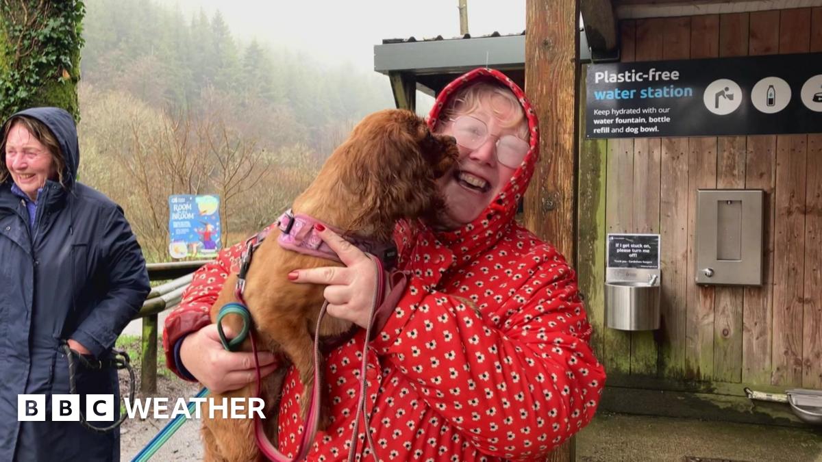
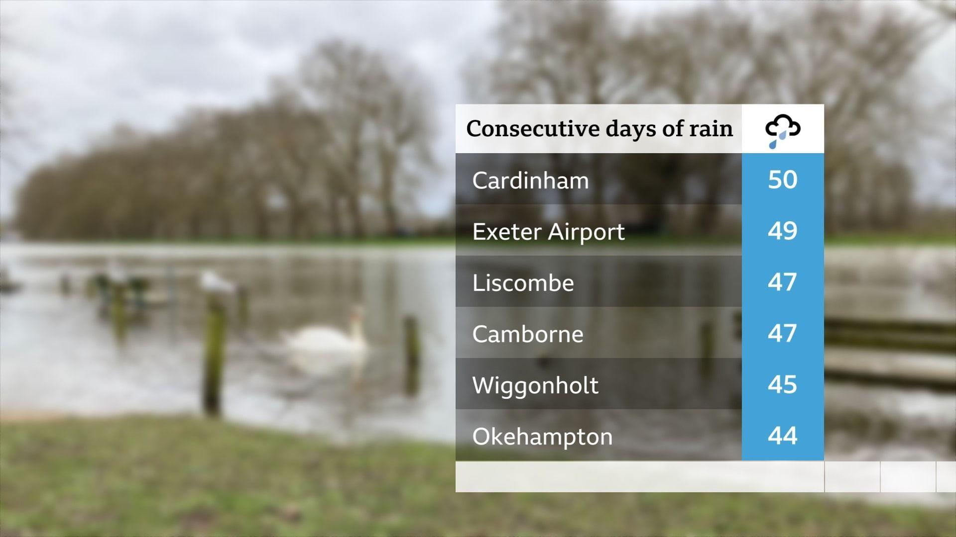
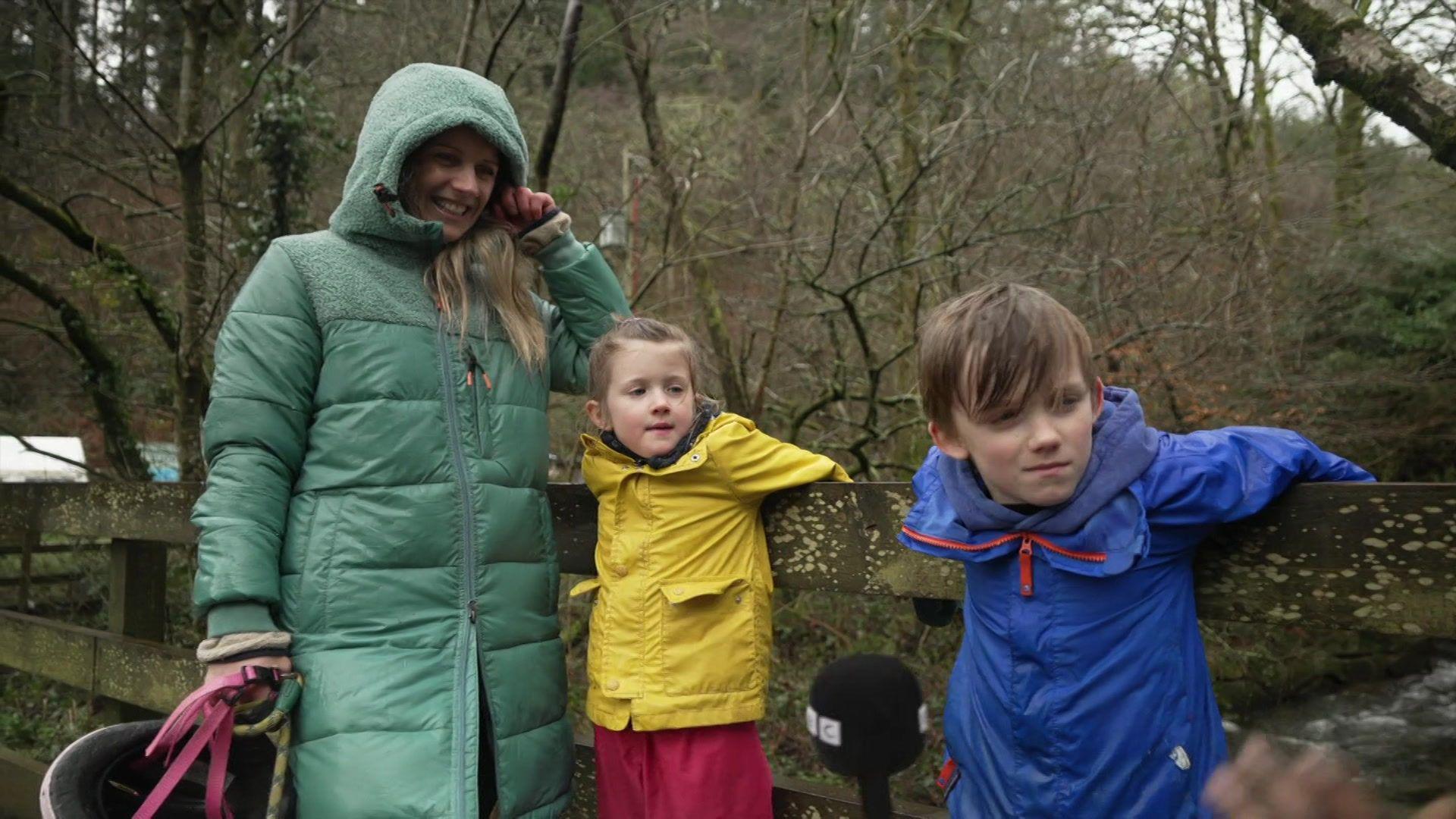
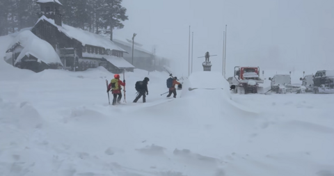
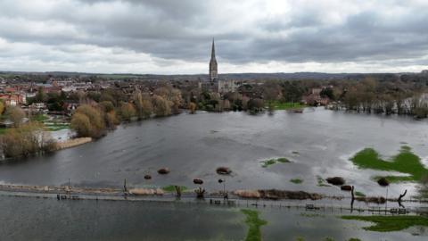
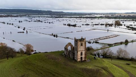
For the small Cornish village of Cardinham the rain so far this year really has been relentless.

According to the Met Office, it has rained there every day for the last 50 days.

The last dry day residents experienced was 30 December 2025. They have already received more than their normal rainfall for February.

The one ray of light? This is still well short of the previous longest wet spell in Cardinham of 72 days recorded in 2000.

Elsewhere in the UK, the persistent rain over recent weeks has resulted in ongoing flooding with no significant let up expected until the middle of next month at the earliest.

Number of rainy days for parts of southern England

Exeter, Liscombe, Camborne and Okehampton all in the south-west have experienced between 44 and 49 days of continuous rain. Wiggenholt in West Sussex has had 45 days.

Katesbridge, in Northern Ireland has now clocked up 40 days of wet weather, already seeing over two and a half times its February average rainfall.

At Ryhill, West Yorkshire it had rained every day for the previous 36, prior to Wednesday.

Northern Ireland experienced its wettest January in 149 years, and at Aboyne in Aberdeenshire over half the average rainfall for the entire year has already been recorded.

Flooding may worsen as unsettled weather expected to last for another month at least

UK Flood Warnings

For some residents of Cardinham, the relentless rain is starting to take its toll.

Will Palmer, who normally enjoys outdoor activities like walking his dog and cycling, told the BBC that the weather was "miserable".

It has added further challenges for parents who are looking for ways to keep their children busy over half-term.

Laura, mum to Harriet and Rupert, complained that her house "has never been more full of sopping wet clothes".

She said: "It's tough when you have a dog and two young children...but you've got to get out there and do it."

While mum Laura has had to deal with sopping wet clothes, Harriet and Rupert have been finding the rain "fun"

The main reason for the relentlessness of the rain is linked to a "stuck" weather pattern that developed across Europe shortly after the New Year.

A large area of high pressure became established across northern and eastern parts of the continent, with cold air become strongly established underneath it.

At the same time surges of Arctic air in the USA and Canada helped to fire up a strong Atlantic jet stream that directed rain-bearing areas of low pressure towards western Europe.

The area of high pressure stopped the progress of the lows, meaning the same areas - namely the UK, Spain and Portugal - have been hit again and again by spells of wet weather.

However, this blocked system has meant that some areas of the UK have escaped the worst of the rain. Parts of north-west England and western Scotland have been experiencing 'below-average' rainfall, with some of the Highlands having experienced a stretch of nearly three weeks without seeing any rain.

This soggy start to the year reflects long-term trends that show winters in the UK are getting warmer and wetter due to climate change.

A warmer atmosphere is able to hold more moisture meaning that when rain comes it is likely to be heavier and more intense.

This weekend some parts of the UK may experience their first burst of spring 'warmth', with temperatures of 15 or 16C possible in a few spots. However, it doesn't mean that sunshine and dry weather is back.

Rain will still feature across the UK during the weekend despite south-westerly winds dragging in milder conditions.

The Met Office have said that there is no sign of prolonged dry weather until the middle of March at the very least, with our weather remaining very "changeable".

Despite this, the blocked weather pattern that has been the reason for all our problems so far this year has finally changed. It means that low pressure systems will sit in different areas and also progress across the UK more than they have done. The result will be a different distribution of rainfall across the country, with some western hills likely to experience the wetter conditions.

There should also be a few more drier and brighter days, but with rivers still very high and the ground saturated in large parts of the country any further rain could still bring the risk of more flooding.

After the unusually dry conditions through a large part of 2025, and the resulting drought in a number of areas, the turn around to flood has been fairly rapid.

Monthly Outlook

Are wetter winters and frequent flooding here to stay?

Comments can not be loaded

To load Comments you need to enable JavaScript in your browser